Geolocate

Colgan topographic map

Click on the map to display elevation.

About this map
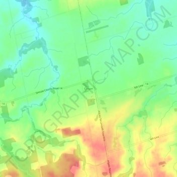
Name: Colgan topographic map, elevation, terrain.

Location: Colgan, Adjala–Tosorontio, Simcoe County, Central Ontario, Ontario, L0G 1W0, Canada (44.00871 -79.86875 44.04871 -79.82875)

Average elevation: 856 ft

Minimum elevation: 758 ft

Maximum elevation: 991 ft

Other topographic maps

Click on a map to view its topography, its elevation and its terrain.

Gear up for your next adventure:

📶Satellite Messenger - Communication device off‑grid
🔭Telescopic Hiking Pole - Adjustable pole for hiking stability
📶Vehicle Signal Boosters - Improve reception in rural areas while driving to trailheads
🔥Fast-Boil Camping Stoves - Efficient cooking systems for quick trail meals
🚑Emergency Bivvies - Heat-reflective sleeping bags for survival situations

As an Amazon Associate, this site earns from qualifying purchases at no extra cost to you.