Geolocate

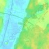
Gvardeysk topographic map

Click on the map to display elevation.

About this map

Name: Gvardeysk topographic map, elevation, terrain.

Location: Gvardeysk, Gvardeysky District, Kaliningrad, Northwestern Federal District, 238210, Russia (54.62757 21.01867 54.67232 21.11133)

Average elevation: 26 ft

Minimum elevation: -43 ft

Maximum elevation: 85 ft

Other topographic maps

Click on a map to view its topography, its elevation and its terrain.

17.9

Russia > Kaliningrad > Gvardeysky District

Average elevation: 30 ft

Gear up for your next adventure:

🔌Solar Panel Charger - Charge gear sustainably outdoors
👖Convertible Hiking Pants - Versatile zip-off pants for changing altitudes and temperatures
⛑️Personal Locator Beacon - Safety beacon for emergencies
🔭Stargazing Telescopes - Perfect for camping in low-light pollution areas shown on maps
🧭Outdoor Navigation Book - Learn advanced navigation skills

As an Amazon Associate, this site earns from qualifying purchases at no extra cost to you.