Geolocate

Providence Bay topographic map

Click on the map to display elevation.

About this map
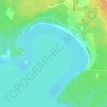
Name: Providence Bay topographic map, elevation, terrain.

Location: Providence Bay, Central Manitoulin, Manitoulin District, Northeastern Ontario, Ontario, P0P 1T0, Canada (45.66267 -82.27659 45.66277 -82.27649)

Average elevation: 591 ft

Minimum elevation: 561 ft

Maximum elevation: 653 ft

Other topographic maps

Click on a map to view its topography, its elevation and its terrain.

Gear up for your next adventure:

🧤Hiking Gloves - Protective gloves for rugged trails
🥾Women's Hiking Boots - Top-rated trail boots with ankle support and superior grip
🛰️Satellite Messengers - Emergency SOS and two-way messaging for off-grid adventures
🎒Trekking Poles - Sturdy poles for balance and stability on rough terrain
🧦Hiking Socks - Comfortable socks to prevent blisters on long hikes

As an Amazon Associate, this site earns from qualifying purchases at no extra cost to you.