Geolocate

Tagore hill topographic map

Click on the map to display elevation.

About this map

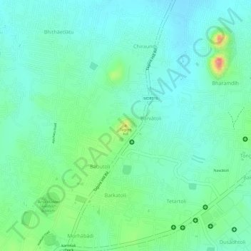
Name: Tagore hill topographic map, elevation, terrain.

Location: Tagore hill, Ranchi, Kanke, Ranchi, Jharkhand, 834008, India (23.40138 85.33798 23.40148 85.33808)

Average elevation: 2,100 ft

Minimum elevation: 2,018 ft

Maximum elevation: 2,303 ft

Other topographic maps

Click on a map to view its topography, its elevation and its terrain.

Rock Garden

India > Jharkhand > Kanke > Ranchi

Average elevation: 2,113 ft

Ranchi Lake (Bada Talab)

India > Jharkhand > Kanke > Ranchi

Average elevation: 2,133 ft

Gear up for your next adventure:

🧼Biodegradable Camping Soap - Eco‑friendly soap for outdoor hygiene
🔌USB Car Charger - Car charger for on‑the‑go power needs
🛠️Backpacking Tool Kit - Essential toolkit for outdoor repairs
🪶Multi‑Purpose Knife - Useful blade for camp and trail
🎁Geography Themed Gifts - Unique gift ideas for map lovers and geography enthusiasts

As an Amazon Associate, this site earns from qualifying purchases at no extra cost to you.