
勃利县 topographic map
Interactive map
Click on the map to display elevation.
About this map
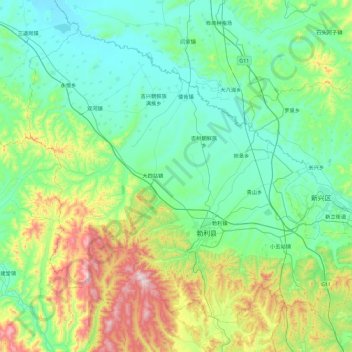
Name: 勃利县 topographic map, elevation, terrain.
Location: 勃利县, 七台河市, 黑龙江省, 154600, 中国 (45.58649 130.09624 46.12013 131.01683)
Average elevation: 981 ft
Minimum elevation: 390 ft
Maximum elevation: 3,251 ft
Other topographic maps
Click on a map to view its topography, its elevation and its terrain.