Geolocate

Forest Road topographic map

Click on the map to display elevation.

About this map

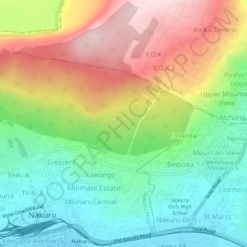
Name: Forest Road topographic map, elevation, terrain.

Location: Forest Road, Nakuru, Kenya (-0.28539 36.06435 -0.24539 36.10435)

Average elevation: 6,588 ft

Minimum elevation: 6,040 ft

Maximum elevation: 7,379 ft

Gear up for your next adventure:

🌡️Handheld Weather Meters - Measure wind, temp, and pressure for safe mountain travel
🌧️Backpack Rain Cover - Keep gear dry in wet weather
Backpacking Tent - Lightweight and durable tent for multi‑day hikes
🪑Ultralight Camp Chairs - Portable seating for resting after a long day of mapping
📚USA Hiking Guide Books - Top trail guides and map books

As an Amazon Associate, this site earns from qualifying purchases at no extra cost to you.