
Thank you for supporting this site ❤️
Make a donation
Make a donation
Gear up for your next adventure:
As an Amazon Associate, this site earns from qualifying purchases at no extra cost to you.
Azov topographic map
Click on the map to display elevation.
Thank you for supporting this site ❤️
Make a donation
Make a donation
Gear up for your next adventure:
As an Amazon Associate, this site earns from qualifying purchases at no extra cost to you.
About this map
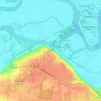
Name: Azov topographic map, elevation, terrain.
Location: Azov, Rostov Oblast, Southern Federal District, 346787, Russia (47.07392 39.38597 47.15392 39.46597)
Average elevation: 52 ft
Minimum elevation: -7 ft
Maximum elevation: 167 ft
Thank you for supporting this site ❤️
Make a donation
Make a donation
Gear up for your next adventure:
As an Amazon Associate, this site earns from qualifying purchases at no extra cost to you.