
Make a donation
Gear up for your next adventure:
As an Amazon Associate, this site earns from qualifying purchases at no extra cost to you.
Lena River topographic map
Click on the map to display elevation.
Make a donation
Gear up for your next adventure:
As an Amazon Associate, this site earns from qualifying purchases at no extra cost to you.
Lena River
Originating at an elevation of 1,640 meters (5,381 ft) at its source in the Baikal Mountains south of the Central Siberian Plateau, 7 kilometres (4 mi) west of Lake Baikal, the Lena flows northeast across the Lena-Angara Plateau, being joined by the Kirenga, Vitim and Olyokma. From Yakutsk it enters the Central Yakutian Lowland and flows north until joined by its right-hand tributary the Aldan and its most important left-hand tributary, the Vilyuy. After that, it bends westward and northward, flowing between the Kharaulakh Range, part of the Verkhoyansk Range, in the east and the Chekanovsky Ridge in the west. Making its way nearly due north it expands into a large delta and ends in the Laptev Sea, a division of the Arctic Ocean, south-west of the New Siberian Islands. The Lena Delta is 30,000 square kilometres (12,000 sq mi) in area, being traversed by seven main branches, the most important being the Bykovsky channel, farthest east.
Make a donation
Gear up for your next adventure:
As an Amazon Associate, this site earns from qualifying purchases at no extra cost to you.
About this map
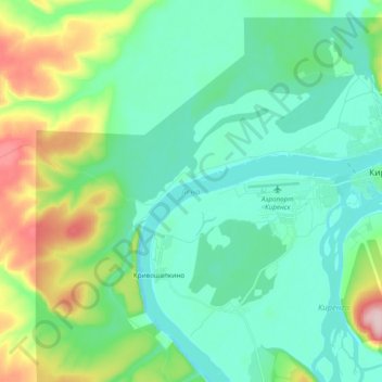
Name: Lena River topographic map, elevation, terrain.
Average elevation: 951 ft
Minimum elevation: 768 ft
Maximum elevation: 1,529 ft
Make a donation
Gear up for your next adventure:
As an Amazon Associate, this site earns from qualifying purchases at no extra cost to you.