Geolocate

Turner topographic map

Click on the map to display elevation.

About this map

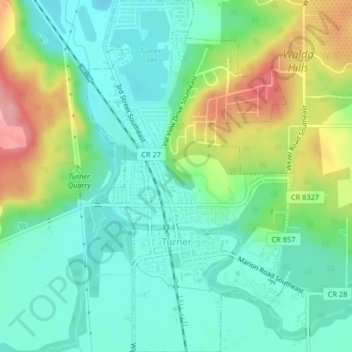
Name: Turner topographic map, elevation, terrain.

Location: Turner, Marion County, Oregon, United States (44.83408 -122.96331 44.86308 -122.93980)

Average elevation: 364 ft

Minimum elevation: 233 ft

Maximum elevation: 640 ft

Marion County trails, hiking, mountain biking, running and outdoor activities

Other topographic maps

Click on a map to view its topography, its elevation and its terrain.

Labish Center

United States > Oregon > Marion County

Average elevation: 167 ft

Brooks

United States > Oregon > Marion County

Average elevation: 180 ft

Fruitland

United States > Oregon > Marion County > Fruitland

Average elevation: 210 ft

Jawbone Flats

United States > Oregon > Marion County

Average elevation: 2,887 ft

West Stayton

United States > Oregon > Marion County

Average elevation: 381 ft

Gear up for your next adventure:

🪑Ultralight Camp Chairs - Portable seating for resting after a long day of mapping
😴Insulated Sleeping Pads - Compact and warm pads for high-elevation camping
🔌Solar Panel Charger - Charge gear sustainably outdoors
🎒Hydration Pack - Hands‑free water reservoir for long hikes
🥾Hiking Shoes - Durable and comfortable shoes for trail hiking

As an Amazon Associate, this site earns from qualifying purchases at no extra cost to you.