
Make a donation
Gear up for your next adventure:
As an Amazon Associate, this site earns from qualifying purchases at no extra cost to you.
West Stayton topographic map
Click on the map to display elevation.
Make a donation
Gear up for your next adventure:
As an Amazon Associate, this site earns from qualifying purchases at no extra cost to you.
About this map
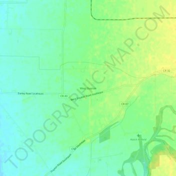
Name: West Stayton topographic map, elevation, terrain.
Location: West Stayton, Marion County, Oregon, United States (44.76651 -122.88676 44.80651 -122.84676)
Average elevation: 381 ft
Minimum elevation: 348 ft
Maximum elevation: 420 ft
Marion County trails, hiking, mountain biking, running and outdoor activities
Make a donation
Gear up for your next adventure:
As an Amazon Associate, this site earns from qualifying purchases at no extra cost to you.
Other topographic maps
Click on a map to view its topography, its elevation and its terrain.
Make a donation
Gear up for your next adventure:
As an Amazon Associate, this site earns from qualifying purchases at no extra cost to you.
Make a donation
Gear up for your next adventure:
As an Amazon Associate, this site earns from qualifying purchases at no extra cost to you.
Mount Angel
United States > Oregon > Marion County > Mount Angel
Rev. Fr. Adelhelm Odermatt, O.S.B., came to Oregon in 1881 with a contingent of Benedictine monks from Engelberg, Switzerland, in order to establish a new American daughter house. After visiting several locations, he found Lone Butte to be the ideal location for a new abbey, and shortly afterwards ministered…
Average elevation: 190 ft
Make a donation
Gear up for your next adventure:
As an Amazon Associate, this site earns from qualifying purchases at no extra cost to you.