
Madge topographic map
Click on the map to display elevation.
About this map
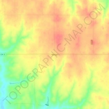
Name: Madge topographic map, elevation, terrain.
Location: Madge, Harmon County, Oklahoma, 73571, United States (34.88033 -99.97844 34.92033 -99.93844)
Average elevation: 1,913 ft
Minimum elevation: 1,785 ft
Maximum elevation: 1,985 ft
Harmon County trails, hiking, mountain biking, running and outdoor activities
Other topographic maps
Click on a map to view its topography, its elevation and its terrain.