Geolocate

Velika topographic map

Click on the map to display elevation.

About this map

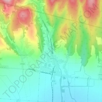
Name: Velika topographic map, elevation, terrain.

Location: Velika, Općina Velika, Požega-Slavonia County, 34330, Croatia (45.42355 17.64503 45.46355 17.68503)

Average elevation: 876 ft

Minimum elevation: 666 ft

Maximum elevation: 1,316 ft

Other topographic maps

Click on a map to view its topography, its elevation and its terrain.

Grad Požega

Croatia > Požega-Slavonia County

Požega (elevation: 152 m (499 ft)) is located in the south-western part of the Valley of Požega, or Požega basin, in Croatian: Požeška kotlina. This fertile valley has been important since the antiquity - its Roman name was Vallis Aurea, meaning "golden valley".

Average elevation: 728 ft

Gear up for your next adventure:

🪵Folding Camp Saw - Compact saw for wood and campsite work
🧭Pro Hiking Compasses - High-accuracy liquid-filled compasses for topographic orientation
🔪Outdoor Multitools - Essential survival tools for gear repair and field use
🌎3D Topographic Globes - Raised relief globes for a tactile understanding of geography
🥤Water Filter Bottle - All‑in‑one filter bottle for safe hydration

As an Amazon Associate, this site earns from qualifying purchases at no extra cost to you.