Geolocate

Dalmellington topographic map

Click on the map to display elevation.

About this map

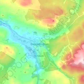
Name: Dalmellington topographic map, elevation, terrain.

Location: Dalmellington, East Ayrshire, Scotland, KA6 7QU, United Kingdom (55.28325 -4.43703 55.36325 -4.35703)

Average elevation: 935 ft

Minimum elevation: 515 ft

Maximum elevation: 1,736 ft

Other topographic maps

Click on a map to view its topography, its elevation and its terrain.

Glenbuck Loch

United Kingdom > Scotland > East Ayrshire

Average elevation: 1,073 ft

River Doon

United Kingdom > Scotland > East Ayrshire > Dalrymple

Average elevation: 551 ft

River Ayr

United Kingdom > Scotland > East Ayrshire

Average elevation: 689 ft

Braid Wood

United Kingdom > Scotland > East Ayrshire

Average elevation: 374 ft

Loch Doon

United Kingdom > Scotland > East Ayrshire

Average elevation: 955 ft

Gear up for your next adventure:

📷Action Cameras - Rugged cameras to document your journeys across rugged terrain
🪵Folding Camp Saw - Compact saw for wood and campsite work
🥇GPS Hiking Watch - Multi‑sport GPS watch with navigation and trail tracking
📚USA Hiking Guide Books - Top trail guides and map books
🪶Compact Camp Shovel - Folding shovel for campsite tasks

As an Amazon Associate, this site earns from qualifying purchases at no extra cost to you.