
Isani-Samgori Raion topographic map
Click on the map to display elevation.
About this map
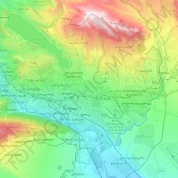
Name: Isani-Samgori Raion topographic map, elevation, terrain.
Location: Isani-Samgori Raion, Tbilisi, Georgia (41.62039 44.78199 41.76875 45.01780)
Average elevation: 2,037 ft
Minimum elevation: 1,135 ft
Maximum elevation: 4,304 ft
Other topographic maps
Click on a map to view its topography, its elevation and its terrain.