
Banha topographic map
Interactive map
Click on the map to display elevation.
About this map
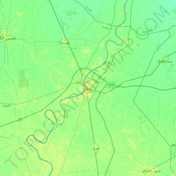
Name: Banha topographic map, elevation, terrain.
Location: Banha, Al Qalyubiya, 13512, Egypt (30.30250 31.02406 30.62250 31.34406)
Average elevation: 43 ft
Minimum elevation: 20 ft
Maximum elevation: 79 ft
Other topographic maps
Click on a map to view its topography, its elevation and its terrain.
Shubra al Khayma
Shubra al Khayma, Al Qalyubiya, 13771, Egypt
Average elevation: 148 ft
Mansuret Namul
Egypt > Al Qalyubiya > Mansuret Namul
Mansuret Namul, Al Qalyubiya, 13737, Egypt
Average elevation: 46 ft
Shebin el Qanater
Shebin el Qanater, Al Qalyubiya, 13711, Egypt
Average elevation: 49 ft