
Lac Swell topographic map
Click on the map to display elevation.
About this map
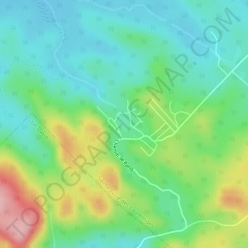
Name: Lac Swell topographic map, elevation, terrain.
Average elevation: 1,427 ft
Minimum elevation: 1,257 ft
Maximum elevation: 1,798 ft
Other topographic maps
Click on a map to view its topography, its elevation and its terrain.
Mont Kaaikop
Canada > Quebec > Les Laurentides > Sainte-Lucie-des-Laurentides
Average elevation: 2,034 ft