
Thank you for supporting this site ❤️
Make a donation
Make a donation
Gear up for your next adventure:
As an Amazon Associate, this site earns from qualifying purchases at no extra cost to you.
Bameka topographic map
Click on the map to display elevation.
Thank you for supporting this site ❤️
Make a donation
Make a donation
Gear up for your next adventure:
As an Amazon Associate, this site earns from qualifying purchases at no extra cost to you.
About this map
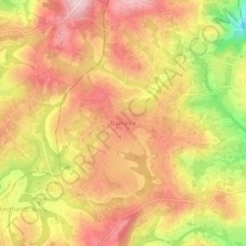
Name: Bameka topographic map, elevation, terrain.
Location: Bameka, Bamendjou, Hauts-Plateaux, West, Cameroon (5.41045 10.31767 5.45045 10.35767)
Average elevation: 4,957 ft
Minimum elevation: 4,475 ft
Maximum elevation: 5,240 ft
Thank you for supporting this site ❤️
Make a donation
Make a donation
Gear up for your next adventure:
As an Amazon Associate, this site earns from qualifying purchases at no extra cost to you.