
Greyback Lake topographic map
Click on the map to display elevation.
About this map
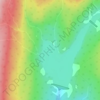
Name: Greyback Lake topographic map, elevation, terrain.
Average elevation: 5,338 ft
Minimum elevation: 5,079 ft
Maximum elevation: 5,719 ft
Other topographic maps
Click on a map to view its topography, its elevation and its terrain.
Chute Lake
Canada > British Columbia > Regional District of Okanagan-Similkameen > Area E (Naramata/Greyback)
Average elevation: 4,177 ft
Naramata
Canada > British Columbia > Regional District of Okanagan-Similkameen > Area E (Naramata/Greyback)
Average elevation: 1,358 ft
Okanagan Mountain Provincial Park
Canada > British Columbia > Regional District of Okanagan-Similkameen > Area E (Naramata/Greyback)
Average elevation: 2,621 ft
Okanagan Highland
Canada > British Columbia > Regional District of Okanagan-Similkameen > Area E (Naramata/Greyback)
Average elevation: 2,677 ft