Geolocate

Collier Street topographic map

Click on the map to display elevation.

About this map

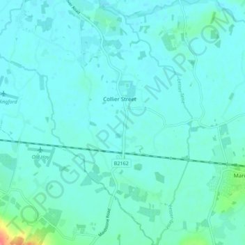
Name: Collier Street topographic map, elevation, terrain.

Location: Collier Street, Maidstone, Kent, England, United Kingdom (51.15817 0.42412 51.21118 0.47800)

Average elevation: 59 ft

Minimum elevation: 33 ft

Maximum elevation: 233 ft

Other topographic maps

Click on a map to view its topography, its elevation and its terrain.

Westfield Sole

United Kingdom > England > Kent > Maidstone

Average elevation: 476 ft

Detling Hill

United Kingdom > England > Kent > Maidstone

Average elevation: 499 ft

Mote Park

United Kingdom > England > Kent > Maidstone > Otham

Average elevation: 171 ft

Broomfield

United Kingdom > England > Kent > Maidstone > Leeds

Average elevation: 315 ft

Lenham Heath

United Kingdom > England > Kent > Maidstone

Average elevation: 315 ft

Leadingcross Green

United Kingdom > England > Kent > Maidstone > Lenham

Average elevation: 387 ft

Walderslade Woods

United Kingdom > England > Kent > Maidstone

Average elevation: 509 ft

Harpole

United Kingdom > England > Kent > Maidstone > Detling

Average elevation: 338 ft

Bletchenden

United Kingdom > England > Kent > Maidstone > Headcorn

Average elevation: 79 ft

Liverton Street

United Kingdom > England > Kent > Maidstone > Grafty Green

Average elevation: 335 ft

Linton

United Kingdom > England > Kent > Maidstone

Average elevation: 233 ft

East Lenham

United Kingdom > England > Kent > Maidstone > Lenham

Average elevation: 417 ft

Bicknor Wood

United Kingdom > England > Kent > Maidstone > Otham

Average elevation: 279 ft

Laddingford

United Kingdom > England > Kent > Maidstone > Yalding

Average elevation: 46 ft

Langley Park

United Kingdom > England > Kent > Maidstone > Langley

Average elevation: 315 ft

Bletchingly

United Kingdom > England > Kent > Maidstone

Average elevation: 121 ft

Weavering Park

United Kingdom > England > Kent > Maidstone > Grove Green

Average elevation: 184 ft

Eyhorne Street

United Kingdom > England > Kent > Maidstone > Hollingbourne

Average elevation: 295 ft

Kingswood

United Kingdom > England > Kent > Maidstone

Average elevation: 358 ft

Gear up for your next adventure:

🪶Camping Sleeping Pad - Comfortable sleeping pad for backpacking
🪶Compact Camp Shovel - Folding shovel for campsite tasks
🔋Solar Power Banks - Keep your GPS and phone charged in remote wilderness areas
📡Handheld GPS Device - Reliable handheld GPS for outdoor navigation
🪑Portable Camp Table - Compact table for campsite meals

As an Amazon Associate, this site earns from qualifying purchases at no extra cost to you.