
Thank you for supporting this site ❤️
Make a donation
Make a donation
Gear up for your next adventure:
As an Amazon Associate, this site earns from qualifying purchases at no extra cost to you.
Samḥa topographic map
Click on the map to display elevation.
Thank you for supporting this site ❤️
Make a donation
Make a donation
Gear up for your next adventure:
As an Amazon Associate, this site earns from qualifying purchases at no extra cost to you.
About this map
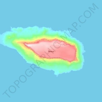
Name: Samḥa topographic map, elevation, terrain.
Location: Samḥa, Qulansiyah wa `Abd al Kuri, Socotra Governorate, Yemen (12.12529 52.97950 12.17962 53.08985)
Average elevation: 256 ft
Minimum elevation: 0 ft
Maximum elevation: 2,382 ft
Thank you for supporting this site ❤️
Make a donation
Make a donation
Gear up for your next adventure:
As an Amazon Associate, this site earns from qualifying purchases at no extra cost to you.
Other topographic maps
Click on a map to view its topography, its elevation and its terrain.