
大武镇 topographic map
Interactive map
Click on the map to display elevation.
About this map
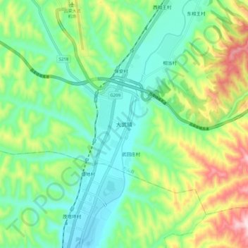
Name: 大武镇 topographic map, elevation, terrain.
Location: 大武镇, 方山县, 吕梁市, 山西省, 中国 (37.60571 111.12198 37.68571 111.20198)
Average elevation: 3,606 ft
Minimum elevation: 3,153 ft
Maximum elevation: 4,606 ft
Other topographic maps
Click on a map to view its topography, its elevation and its terrain.