Geolocate

Inman Lake topographic map

Click on the map to display elevation.

About this map

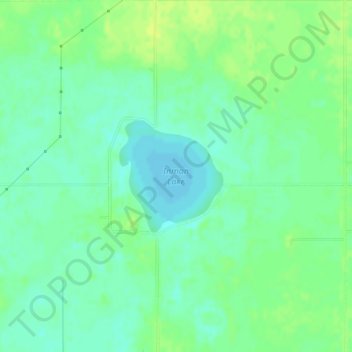
Name: Inman Lake topographic map, elevation, terrain.

Location: Inman Lake, McPherson County, Kansas, United States (38.24279 -97.72411 38.25137 -97.71391)

Average elevation: 1,460 ft

Minimum elevation: 1,434 ft

Maximum elevation: 1,483 ft

McPherson County trails, hiking, mountain biking, running and outdoor activities

Other topographic maps

Click on a map to view its topography, its elevation and its terrain.

McPherson

United States > Kansas > McPherson County

Average elevation: 1,496 ft

Inman

United States > Kansas > McPherson County > Inman

Average elevation: 1,506 ft

Gear up for your next adventure:

🦶Carbon Trekking Poles - Reduce knee impact on steep descents with ultra-light poles
📚Navigation Handbooks - Master the art of reading topographic maps and using a compass
🧭Compass with Lanyard - Easy‑carry compass for navigation
🥾Hiking Shoes - Durable and comfortable shoes for trail hiking
🎒Day Hiking Backpack - Lightweight backpack perfect for day trips and outdoor adventures

As an Amazon Associate, this site earns from qualifying purchases at no extra cost to you.