Geolocate

Sundre topographic map

Click on the map to display elevation.

About this map

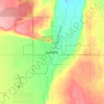
Name: Sundre topographic map, elevation, terrain.

Location: Sundre, Town of Sundre, Alberta, T0M 1X0, Canada (51.75714 -114.67941 51.83714 -114.59941)

Average elevation: 3,698 ft

Minimum elevation: 3,507 ft

Maximum elevation: 3,914 ft

Gear up for your next adventure:

📚USA Hiking Guide Books - Top trail guides and map books
🍳Camping Cook Set - Complete cookware for outdoor meals
🧭Hiking Compass - Precision compass for reliable navigation in the wilderness
💧Water Filtration Bottles - Safely drink from streams and lakes while exploring
🗃️Trail First Aid Kit - Essential kit for outdoor injuries and emergencies

As an Amazon Associate, this site earns from qualifying purchases at no extra cost to you.