Geolocate

博孜墩柯尔克孜族乡 topographic map

Interactive map

Click on the map to display elevation.

About this map

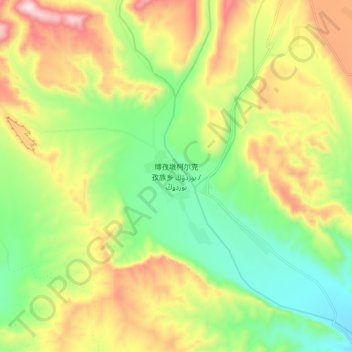
Name: 博孜墩柯尔克孜族乡 topographic map, elevation, terrain.

Location: 博孜墩柯尔克孜族乡, 温宿县, 阿克苏地区, 新疆维吾尔自治区, 中国 (41.68529 80.65849 41.76529 80.73849)

Average elevation: 6,604 ft

Minimum elevation: 5,761 ft

Maximum elevation: 7,776 ft

Other topographic maps

Click on a map to view its topography, its elevation and its terrain.

天山山脉

中国 > 新疆维吾尔自治区 > 温宿县

天山山脉, 温宿县, 阿克苏地区, 新疆维吾尔自治区, 中国

Average elevation: 20,000 ft

天山神木园

中国 > 新疆维吾尔自治区 > 温宿县

天山神木园, 温宿县, 阿克苏地区, 新疆维吾尔自治区, 中国

Average elevation: 5,489 ft

库玛拉克河

中国 > 新疆维吾尔自治区 > 温宿县

库玛拉克河, 温宿县, 阿克苏地区, 新疆维吾尔自治区, 中国

Average elevation: 4,774 ft

柯柯牙镇

中国 > 新疆维吾尔自治区 > 温宿县

柯柯牙镇, 温宿县, 阿克苏地区, 新疆维吾尔自治区, 中国

Average elevation: 4,026 ft

温宿县

中国 > 新疆维吾尔自治区 > 温宿县

温宿县, 阿克苏地区, 新疆维吾尔自治区, 中国

Average elevation: 3,885 ft