
长潭村 topographic map
Interactive map
Click on the map to display elevation.
About this map
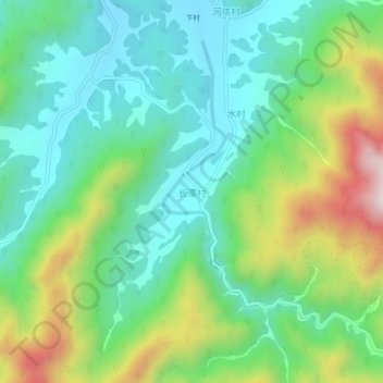
Name: 长潭村 topographic map, elevation, terrain.
Location: 长潭村, 湖州市, 浙江省, 中国 (30.41246 119.36810 30.45246 119.40810)
Average elevation: 1,257 ft
Minimum elevation: 581 ft
Maximum elevation: 2,785 ft
Other topographic maps
Click on a map to view its topography, its elevation and its terrain.