Geolocate

Clonakilty topographic map

Click on the map to display elevation.

About this map

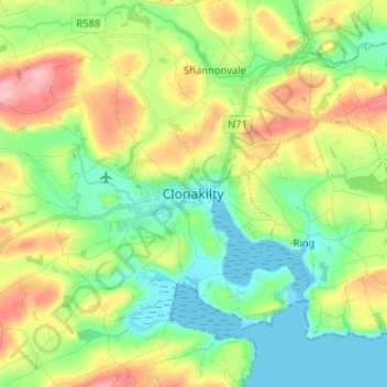
Name: Clonakilty topographic map, elevation, terrain.

Location: Clonakilty, West Cork, County Cork, Munster, P85 T938, Ireland (51.58293 -8.92701 51.66293 -8.84701)

Average elevation: 161 ft

Minimum elevation: -7 ft

Maximum elevation: 449 ft

Gear up for your next adventure:

🔦LED Headlamp - Bright and durable LED headlamp for night navigation
🌄Hiking Binoculars - Compact binoculars for scenic views and trail spotting
🏕️Tent Footprint - Protect your tent base from wear
🎒Waterproof Dry Bags - Keep your electronics and maps dry inside your pack
🪶Thermal Camp Blanket - Extra warmth for cold nights

As an Amazon Associate, this site earns from qualifying purchases at no extra cost to you.