Geolocate

Clonakilty topographic maps

Click on a map to view its topography, its elevation and its terrain.
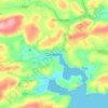
Clonakilty

Ireland > Clonakilty

Average elevation: 161 ft

Gear up for your next adventure:

📌Outdoor GPS Map App - Apps and devices for digital topographic navigation
🌡️Portable Weather Meter - Track weather conditions on the trail
⛺Backpacking Tent - Lightweight and durable tent for multi‑day hikes
🪶Wildlife Field Guides - Learn animal tracking and species ID
📱Heavy-Duty Phone Cases - Drop-proof and waterproof protection for outdoor navigation

As an Amazon Associate, this site earns from qualifying purchases at no extra cost to you.