Geolocate

Friedberg (Hessen) topographic map

Click on the map to display elevation.

About this map
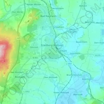
Name: Friedberg (Hessen) topographic map, elevation, terrain.

Location: Friedberg (Hessen), Wetteraukreis, Hesse, 61169, Germany (50.28979 8.63653 50.36448 8.82119)

Average elevation: 587 ft

Minimum elevation: 377 ft

Maximum elevation: 1,680 ft

Other topographic maps

Click on a map to view its topography, its elevation and its terrain.

Der Haag

Germany > Hesse > Wetteraukreis > Melbach

Average elevation: 509 ft

Kreischberg

Germany > Hesse > Wetteraukreis > Büdingen

Average elevation: 699 ft

Gear up for your next adventure:

📱Heavy-Duty Phone Cases - Drop-proof and waterproof protection for outdoor navigation
🎒Hydration Pack - Hands‑free water reservoir for long hikes
🌡️Handheld Weather Meters - Measure wind, temp, and pressure for safe mountain travel
🪶Trail Camera - Capture wildlife on your hikes
🗺️NatGeo Topo Maps - High-quality waterproof printed topographic maps of US Parks

As an Amazon Associate, this site earns from qualifying purchases at no extra cost to you.