Geolocate

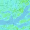
Noorden topographic map

Click on the map to display elevation.

About this map

Name: Noorden topographic map, elevation, terrain.

Location: Noorden, Nieuwkoop, South Holland, Netherlands (52.15922 4.80232 52.17846 4.86785)

Average elevation: -10 ft

Minimum elevation: -30 ft

Maximum elevation: 13 ft

Other topographic maps

Click on a map to view its topography, its elevation and its terrain.

Tweede Tol

Netherlands > South Holland > Dordrecht

Average elevation: 0 ft

Gooland

Netherlands > South Holland > Nootdorp

Average elevation: -7 ft

Langeraar

Netherlands > South Holland

Average elevation: -10 ft

Meije

Netherlands > South Holland > Nieuwkoop

Average elevation: -7 ft

Meijendel

Netherlands > South Holland > Wassenaar

Average elevation: 20 ft

Weerestein

Netherlands > South Holland > Hillegom

Average elevation: 0 ft

Botlek

Netherlands > South Holland

Average elevation: 10 ft

Weerestein

Netherlands > South Holland > Hillegom

Average elevation: 0 ft

Ankerpark

Netherlands > South Holland > Leiden

Average elevation: 10 ft

Waalhaven

Netherlands > South Holland > Rotterdam

Average elevation: 10 ft

Middelsluis

Netherlands > South Holland > Numansdorp

Average elevation: 0 ft

Coepelduynen

Netherlands > South Holland > Katwijk

Average elevation: 13 ft

Broekhuizen

Netherlands > South Holland > Gouda

Average elevation: -3 ft

Het Park

Netherlands > South Holland > Rotterdam

Average elevation: 13 ft

Gear up for your next adventure:

🎒Hydration Pack - Hands‑free water reservoir for long hikes
📱Solar Portable Charger - Solar power bank for charging devices off‑grid
🧢Outdoor Hiking Hat - Sun protection hat for outdoor explorers
🔥Plasma Lighters - Windproof lighters that work in any weather condition
🎒Trekking Poles - Sturdy poles for balance and stability on rough terrain

As an Amazon Associate, this site earns from qualifying purchases at no extra cost to you.