Geolocate

Pilot Rock topographic map

Click on the map to display elevation.

About this map

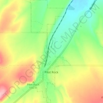
Name: Pilot Rock topographic map, elevation, terrain.

Location: Pilot Rock, Umatilla County, Oregon, 97868, United States (45.46959 -118.84332 45.51535 -118.81762)

Average elevation: 1,729 ft

Minimum elevation: 1,486 ft

Maximum elevation: 2,051 ft

Other topographic maps

Click on a map to view its topography, its elevation and its terrain.

Meacham

United States > Oregon > Umatilla County

Average elevation: 3,825 ft

Tollgate

United States > Oregon > Umatilla County

Average elevation: 4,961 ft

Myrick

United States > Oregon > Umatilla County

Average elevation: 1,755 ft

Hinkle

United States > Oregon > Umatilla County

Average elevation: 584 ft

Nolin

United States > Oregon > Umatilla County

Average elevation: 968 ft

Wallula Gap

United States > Oregon > Umatilla County

Average elevation: 1,027 ft

Gear up for your next adventure:

🧭Pro Hiking Compasses - High-accuracy liquid-filled compasses for topographic orientation
🧢Outdoor Hiking Hat - Sun protection hat for outdoor explorers
🪓Survival Multi‑Tool - Versatile tool for camp and trail tasks
🪑Ultralight Camp Chairs - Portable seating for resting after a long day of mapping
🚪Portable Camp Chair - Foldable chair for comfort at camp

As an Amazon Associate, this site earns from qualifying purchases at no extra cost to you.