Geolocate

Ocean Rocks Viewpoint topographic map

Click on the map to display elevation.

About this map

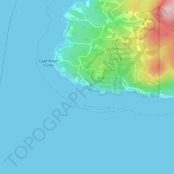
Name: Ocean Rocks Viewpoint topographic map, elevation, terrain.

Location: Ocean Rocks Viewpoint, Ocean Rocks Trail, Cape Roger Curtis, Bowen Island Municipality, Metro Vancouver Regional District, British Columbia, Canada (49.33626 -123.42408 49.33636 -123.42398)

Average elevation: 108 ft

Minimum elevation: -10 ft

Maximum elevation: 794 ft

Other topographic maps

Click on a map to view its topography, its elevation and its terrain.

Gear up for your next adventure:

🔥Camping Stove - Portable stove for camping and backcountry cooking
🗺️NatGeo Topo Maps - High-quality waterproof printed topographic maps of US Parks
🧯Emergency Survival Kit - All‑in‑one survival essentials for the backcountry
📚Navigation Handbooks - Master the art of reading topographic maps and using a compass
🚪Portable Camp Chair - Foldable chair for comfort at camp

As an Amazon Associate, this site earns from qualifying purchases at no extra cost to you.