
North Richland Hills topographic map
Interactive map
Click on the map to display elevation.
About this map
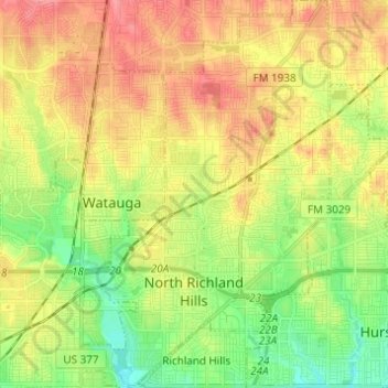
Name: North Richland Hills topographic map, elevation, terrain.
Location: North Richland Hills, Tarrant County, Texas, United States (32.80874 -97.26452 32.91181 -97.18592)
Average elevation: 627 ft
Minimum elevation: 505 ft
Maximum elevation: 758 ft
Tarrant County trails, hiking, mountain biking, running and outdoor activities
Other topographic maps
Click on a map to view its topography, its elevation and its terrain.