Geolocate

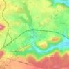
Beaulieu topographic map

Click on the map to display elevation.

About this map

Name: Beaulieu topographic map, elevation, terrain.

Location: Beaulieu, Hortes, Haute-Amance, Langres, Haute-Marne, Grand Est, France métropolitaine, 52600, France (47.80514 5.54769 47.84514 5.58769)

Average elevation: 1,004 ft

Minimum elevation: 791 ft

Maximum elevation: 1,234 ft

Other topographic maps

Click on a map to view its topography, its elevation and its terrain.
Montlandon

France > Grand Est > Haute-Marne > Haute-Amance

Average elevation: 1,135 ft

Rosoy-sur-Amance

France > Grand Est > Haute-Marne > Haute-Amance

Average elevation: 1,030 ft

Gear up for your next adventure:

🚑Emergency Bivvies - Heat-reflective sleeping bags for survival situations
🪶Wildlife Field Guides - Learn animal tracking and species ID
🧼Biodegradable Camping Soap - Eco‑friendly soap for outdoor hygiene
⛑️Personal Locator Beacon - Safety beacon for emergencies
🗺️NatGeo Topo Maps - High-quality waterproof printed topographic maps of US Parks

As an Amazon Associate, this site earns from qualifying purchases at no extra cost to you.