
陈汉乡 topographic map
Interactive map
Click on the map to display elevation.
About this map
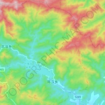
Name: 陈汉乡 topographic map, elevation, terrain.
Location: 陈汉乡, 宿松县, 安庆市, 安徽省, 中国 (30.31730 115.93897 30.43063 116.05061)
Average elevation: 1,201 ft
Minimum elevation: 144 ft
Maximum elevation: 3,222 ft
Other topographic maps
Click on a map to view its topography, its elevation and its terrain.