Eldred topographic map
Click on the map to display elevation.
About this map
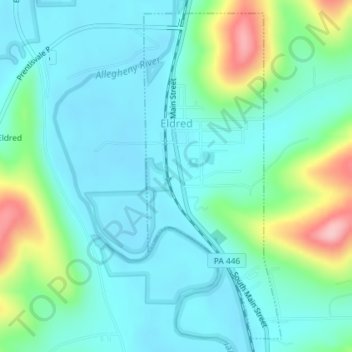
Name: Eldred topographic map, elevation, terrain.
Location: Eldred, McKean County, Pennsylvania, United States (41.94129 -78.38868 41.96626 -78.37448)
Average elevation: 1,535 ft
Minimum elevation: 1,407 ft
Maximum elevation: 1,982 ft
McKean County trails, hiking, mountain biking, running and outdoor activities
Other topographic maps
Click on a map to view its topography, its elevation and its terrain.
Potato Creek
United States > Pennsylvania > McKean County > Keating Township
Average elevation: 1,542 ft

Potato Creek
United States > Pennsylvania > McKean County > Keating Township
Average elevation: 1,562 ft

Red Rock
United States > Pennsylvania > McKean County > Foster Township > Red Rock
Average elevation: 1,959 ft

Potato Creek
United States > Pennsylvania > McKean County > Keating Township
Average elevation: 1,588 ft


Westline
United States > Pennsylvania > McKean County > Lafayette Township
Average elevation: 1,864 ft


Foster Brook
United States > Pennsylvania > McKean County > Foster Township
Average elevation: 1,627 ft