Geolocate

Schipborg topographic map

Click on the map to display elevation.

About this map

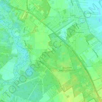
Name: Schipborg topographic map, elevation, terrain.

Location: Schipborg, Aa en Hunze, Drenthe, Netherlands (53.04931 6.64886 53.08403 6.70274)

Average elevation: 26 ft

Minimum elevation: 3 ft

Maximum elevation: 52 ft

Other topographic maps

Click on a map to view its topography, its elevation and its terrain.

Hondsrug

Netherlands > Drenthe > Exloo

Average elevation: 62 ft

Lhee

Netherlands > Drenthe

Average elevation: 36 ft

Zuidbarge

Netherlands > Drenthe > Emmen

Average elevation: 66 ft

Gear up for your next adventure:

🩳Quick‑Dry Hiking Shorts - Comfortable and quick‑dry shorts for summer hiking
🔭Compact Binoculars - HD vision for scouting terrain and identifying distant landmarks
🧷Carabiner Set - Durable clips for gear attachment
🪶Fire Starter Kit - Reliable fire starter for survival and camping
🦟Ultrasonic Repellers - Create a bug-free zone at your camp or rest stop

As an Amazon Associate, this site earns from qualifying purchases at no extra cost to you.