Geolocate

Rampur topographic map

Click on the map to display elevation.

About this map

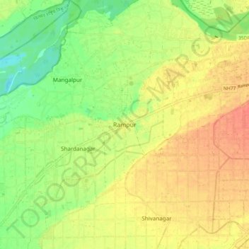
Name: Rampur topographic map, elevation, terrain.

Location: Rampur, Bharatpur, Chitwan, Bagamati Province, 50226, Nepal (27.61062 84.30439 27.69062 84.38439)

Average elevation: 597 ft

Minimum elevation: 515 ft

Maximum elevation: 659 ft

Other topographic maps

Click on a map to view its topography, its elevation and its terrain.

Ratnanagar

Nepal > Bagamati Province > Chitwan

Average elevation: 666 ft

Rapti

Nepal > Bagamati Province > Chitwan

Average elevation: 1,808 ft

Gear up for your next adventure:

🪶Fire Starter Kit - Reliable fire starter for survival and camping
🕶️Glacier Sunglasses - Side shields to protect eyes from high-altitude snow glare
📚Navigation Handbooks - Master the art of reading topographic maps and using a compass
🪓Survival Multi‑Tool - Versatile tool for camp and trail tasks
🏥Hiking First Aid Kits - Comprehensive medical kits for remote trail injuries

As an Amazon Associate, this site earns from qualifying purchases at no extra cost to you.