Geolocate

Derby topographic map

Click on the map to display elevation.

About this map

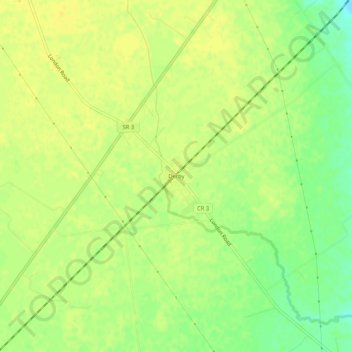
Name: Derby topographic map, elevation, terrain.

Location: Derby, Pickaway County, Ohio, 43117, United States (39.74867 -83.22575 39.78867 -83.18575)

Average elevation: 912 ft

Minimum elevation: 863 ft

Maximum elevation: 932 ft

Pickaway County trails, hiking, mountain biking, running and outdoor activities

Other topographic maps

Click on a map to view its topography, its elevation and its terrain.

Circleville

United States > Ohio > Pickaway County

Average elevation: 696 ft

Ashville

United States > Ohio > Pickaway County

Ashville is located in the Scioto River Valley and has an elevation of 715 feet (218 m) above sea level. The village is located in the till plain-area of Western Ohio and borders the Appalachian Plateau. The area is generally viewed to be a fertile region with gently rolling hills created by moraines.

Average elevation: 709 ft

Darbyville

United States > Ohio > Pickaway County

Average elevation: 768 ft

Orient

United States > Ohio > Pickaway County

Average elevation: 823 ft

Circleville

United States > Ohio > Pickaway County

Average elevation: 696 ft

Hargus Lake

United States > Ohio > Pickaway County

Average elevation: 853 ft

Tarlton

United States > Ohio > Pickaway County

Tarlton's elevation is 902 feet above sea level.

Average elevation: 942 ft

Pickaway Township

United States > Ohio > Pickaway County

Average elevation: 735 ft

Gear up for your next adventure:

🧭Pro Hiking Compasses - High-accuracy liquid-filled compasses for topographic orientation
🔥Fast-Boil Camping Stoves - Efficient cooking systems for quick trail meals
🗃️Trail First Aid Kit - Essential kit for outdoor injuries and emergencies
🔭Telescopic Hiking Pole - Adjustable pole for hiking stability
🚗GPS Dash Cams - Record your scenic drives through mountain passes and canyons

As an Amazon Associate, this site earns from qualifying purchases at no extra cost to you.