Geolocate

Finocchiara topographic map

Click on the map to display elevation.

About this map

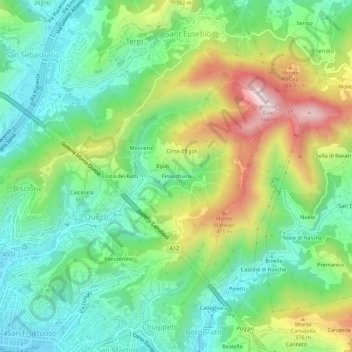
Name: Finocchiara topographic map, elevation, terrain.

Location: Finocchiara, Bassa Val Bisagno, Genoa, Liguria, 16144, Italy (44.40578 8.96414 44.44578 9.00414)

Average elevation: 640 ft

Minimum elevation: 26 ft

Maximum elevation: 1,821 ft

Other topographic maps

Click on a map to view its topography, its elevation and its terrain.

Spianata dell'Acquasola

Italy > Liguria > Genoa > Genoa

Average elevation: 141 ft

Gear up for your next adventure:

🌧️Backpack Rain Cover - Keep gear dry in wet weather
💧Water Purification System - Clean water on the trail with reliable purifiers
🥾Men's Hiking Boots - Durable, waterproof footwear for rugged terrain and steep inclines
🔭Compact Binoculars - HD vision for scouting terrain and identifying distant landmarks
🧭Hiking Compass - Precision compass for reliable navigation in the wilderness

As an Amazon Associate, this site earns from qualifying purchases at no extra cost to you.