Geolocate

Sweeny topographic map

Click on the map to display elevation.

About this map

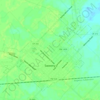
Name: Sweeny topographic map, elevation, terrain.

Location: Sweeny, Brazoria County, Texas, 77480, United States (29.03312 -95.72289 29.06431 -95.67971)

Average elevation: 33 ft

Minimum elevation: 10 ft

Maximum elevation: 46 ft

Brazoria County trails, hiking, mountain biking, running and outdoor activities

Other topographic maps

Click on a map to view its topography, its elevation and its terrain.

Rosharon

United States > Texas > Brazoria County

Average elevation: 52 ft

Clute

United States > Texas > Brazoria County > Clute > Clute

Average elevation: 16 ft

Sandy Point

United States > Texas > Brazoria County

Average elevation: 59 ft

Gear up for your next adventure:

GPS Sports Watch - GPS watch for running, hiking and training
🔪Outdoor Multitools - Essential survival tools for gear repair and field use
💧Water Filtration Bottles - Safely drink from streams and lakes while exploring
📌Outdoor GPS Map App - Apps and devices for digital topographic navigation
🪶Compact Camp Shovel - Folding shovel for campsite tasks

As an Amazon Associate, this site earns from qualifying purchases at no extra cost to you.