Geolocate

Lac-Brome topographic map

Click on the map to display elevation.

About this map

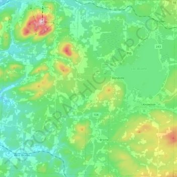
Name: Lac-Brome topographic map, elevation, terrain.

Location: Lac-Brome, Brome-Missisquoi, Estrie, Quebec, Canada (45.15754 -72.69041 45.30751 -72.47821)

Average elevation: 866 ft

Minimum elevation: 453 ft

Maximum elevation: 2,211 ft

Other topographic maps

Click on a map to view its topography, its elevation and its terrain.

Knowlton

Canada > Quebec > Brome-Missisquoi > Lac-Brome

Average elevation: 768 ft

West Brome

Canada > Quebec > Brome-Missisquoi > Lac-Brome

Average elevation: 531 ft

Mont Brome

Canada > Quebec > Brome-Missisquoi > Bromont

Average elevation: 1,086 ft

Gear up for your next adventure:

🧭Map Reading Tools - Tools and kits for map navigation
🛰️Handheld GPS Units - Professional satellite navigators for precise backcountry mapping
📦Dry Bags Set - Waterproof storage for electronics and clothes
🧢Outdoor Hiking Hat - Sun protection hat for outdoor explorers
⛑️Personal Locator Beacon - Safety beacon for emergencies

As an Amazon Associate, this site earns from qualifying purchases at no extra cost to you.