
Augusta topographic map
Click on the map to display elevation.
About this map
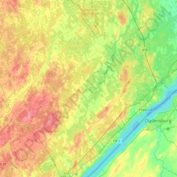
Name: Augusta topographic map, elevation, terrain.
Average elevation: 338 ft
Minimum elevation: 236 ft
Maximum elevation: 459 ft
Other topographic maps
Click on a map to view its topography, its elevation and its terrain.
Pittston
Canada > Ontario > Leeds and Grenville Counties > Edwardsburgh/Cardinal
Average elevation: 269 ft
St. Helena Island
Canada > Ontario > Leeds and Grenville Counties > Front of Yonge
Average elevation: 377 ft
Cockburn Island
Canada > Ontario > Leeds and Grenville Counties > Elizabethtown-Kitley
Average elevation: 367 ft
Waterton
Canada > Ontario > Leeds and Grenville Counties > Leeds and the Thousand Islands > Waterton
Average elevation: 318 ft
Kemptville
Canada > Ontario > Leeds and Grenville Counties > North Grenville
Average elevation: 318 ft