
Thank you for supporting this site ❤️
Make a donation
Make a donation
Gear up for your next adventure:
As an Amazon Associate, this site earns from qualifying purchases at no extra cost to you.
Area J (West Chilcotin) topographic map
Click on the map to display elevation.
Thank you for supporting this site ❤️
Make a donation
Make a donation
Gear up for your next adventure:
As an Amazon Associate, this site earns from qualifying purchases at no extra cost to you.
About this map
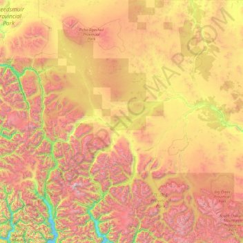
Name: Area J (West Chilcotin) topographic map, elevation, terrain.
Average elevation: 4,646 ft
Minimum elevation: 0 ft
Maximum elevation: 12,428 ft
Thank you for supporting this site ❤️
Make a donation
Make a donation
Gear up for your next adventure:
As an Amazon Associate, this site earns from qualifying purchases at no extra cost to you.
Other topographic maps
Click on a map to view its topography, its elevation and its terrain.
Big Lake
Canada > British Columbia > Cariboo Regional District > Area J (West Chilcotin)
Average elevation: 4,364 ft
Fish Trap (Dean River) Recreation Site
Canada > British Columbia > Cariboo Regional District > Area J (West Chilcotin)
Average elevation: 3,701 ft