Geolocate

Sproul topographic map

Click on the map to display elevation.

About this map

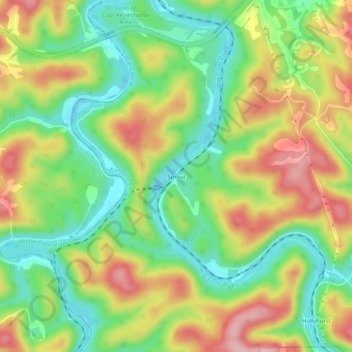
Name: Sproul topographic map, elevation, terrain.

Location: Sproul, Kanawha County, West Virginia, 25003, United States (38.23121 -81.81540 38.27121 -81.77540)

Average elevation: 833 ft

Minimum elevation: 591 ft

Maximum elevation: 1,132 ft

Kanawha County trails, hiking, mountain biking, running and outdoor activities

Other topographic maps

Click on a map to view its topography, its elevation and its terrain.

Nitro

United States > West Virginia > Kanawha County

Average elevation: 722 ft

Coal Fork

United States > West Virginia > Kanawha County

Average elevation: 968 ft

Clendenin

United States > West Virginia > Kanawha County

Average elevation: 860 ft

Gear up for your next adventure:

📚Navigation Handbooks - Master the art of reading topographic maps and using a compass
🪑Portable Camp Table - Compact table for campsite meals
🎒Outdoor Daypacks - Lightweight backpacks designed for carrying maps and essential gear
🦟Ultrasonic Repellers - Create a bug-free zone at your camp or rest stop
🏕️Family Camping Gear - Essentials for group camping trips

As an Amazon Associate, this site earns from qualifying purchases at no extra cost to you.