Geolocate

Ricaurte topographic map

Click on the map to display elevation.

About this map

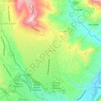
Name: Ricaurte topographic map, elevation, terrain.

Location: Ricaurte, Cuenca, Azuay, 010108, Ecuador (-2.88281 -78.98491 -2.84281 -78.94491)

Average elevation: 8,281 ft

Minimum elevation: 7,877 ft

Maximum elevation: 8,888 ft

Gear up for your next adventure:

🏕️Family Camping Gear - Essentials for group camping trips
📌Outdoor GPS Map App - Apps and devices for digital topographic navigation
🏔️Mountain Trail Maps - High‑detail maps for popular peaks
📚Navigation Handbooks - Master the art of reading topographic maps and using a compass
📷Action Camera - Capture your outdoor adventures in HD

As an Amazon Associate, this site earns from qualifying purchases at no extra cost to you.