Geolocate

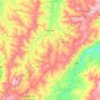
Azuay topographic maps

Click on a map to view its topography, its elevation and its terrain.

Cuenca

Ecuador > Azuay

Average elevation: 8,845 ft

Lentag

Ecuador > Azuay > Girón

Average elevation: 4,931 ft

Chordeleg

Ecuador > Azuay

Average elevation: 9,862 ft

Nabón

Ecuador > Azuay

Average elevation: 8,757 ft

Soldados

Ecuador > Azuay > Cuenca > San Joaquín

Average elevation: 11,719 ft

Giron

Ecuador > Azuay > Girón

The town of Girón is located 44 km southwest of Cuenca by road, at an elevation of 2160 m.

Average elevation: 9,432 ft

Don Julo

Ecuador > Azuay > Guachapala > Guachapala

Average elevation: 7,717 ft

Cochapamba Grande

Ecuador > Azuay > Cuenca > Quingeo

Average elevation: 9,163 ft

Quingeo

Ecuador > Azuay > Cuenca

Average elevation: 9,514 ft

About this place

 •  •

Gear up for your next adventure:

🗺️NatGeo Topo Maps - High-quality waterproof printed topographic maps of US Parks
🧭Orienteering Set - Complete compass and map reading kit
🛡️Insect Repellent - Protection against bugs during outdoor activities
🗻Climbing Gear Basics - Essential gear for beginner climbers
🚪Portable Camp Chair - Foldable chair for comfort at camp

As an Amazon Associate, this site earns from qualifying purchases at no extra cost to you.