
Make a donation
Gear up for your next adventure:
As an Amazon Associate, this site earns from qualifying purchases at no extra cost to you.
Oldambt topographic map
Click on the map to display elevation.
Make a donation
Gear up for your next adventure:
As an Amazon Associate, this site earns from qualifying purchases at no extra cost to you.
Oldambt
In Heiligerlee is de beleefroute in het park De Hoogte en het museum rondom de herdenking van de Slag bij Heiligerlee in trek bij toeristen. In het dorp ligt ook het museum Klokkengieterij. De voormalige strokartonfabriek De Toekomst in Scheemda is een festivallocatie in wording met als belangrijkste festival Grasnapolsky. Andere festivals in de gemeente zijn het festival Hongerige Wolf, straattheaterfestival Waterbei in Winschoten en het promsconcent Pura Vida. In Midwolda is het landgoed rondom de Ennemaborg en de gerestaureerde Oldambtster boerderij Hermans Dijkstra een trekpleister. In Midwolda is ook het noordstrand van het Oldambtmeer te vinden.
Make a donation
Gear up for your next adventure:
As an Amazon Associate, this site earns from qualifying purchases at no extra cost to you.
About this map
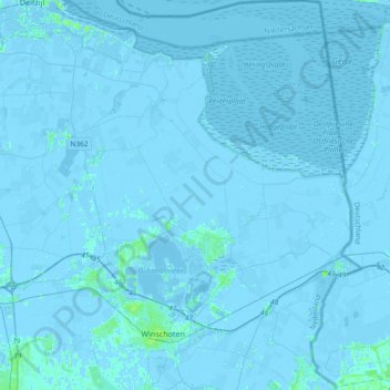
Name: Oldambt topographic map, elevation, terrain.
Location: Oldambt, Groningen, Nederland (53.11083 6.90330 53.33321 7.22750)
Average elevation: -3 ft
Minimum elevation: -23 ft
Maximum elevation: 23 ft
Make a donation
Gear up for your next adventure:
As an Amazon Associate, this site earns from qualifying purchases at no extra cost to you.
Other topographic maps
Click on a map to view its topography, its elevation and its terrain.
Rhederbrug
Het gebied stond eerder als een deel van de Bovenstreek bekend, met achter de Leidijk de Veen- en Boekweitlanden van Bellingwolde. De zandweg naar Rhede dateert van omstreeks 1857. De eerste bebouwing langs deze weg dateert uit de tijd rond 1900. In 1902 opende de school (dan nog te Bovenstreek) zijn deuren.…
Average elevation: 7 ft
Make a donation
Gear up for your next adventure:
As an Amazon Associate, this site earns from qualifying purchases at no extra cost to you.
Jipsinghuizen
Een kilometer ten zuidoosten van Jipsinghuizen werd in 1918 de Jipsinghuizersluis aangelegd in het Ruiten-Aa-kanaal, dat zelf in 1916 gereed kwam. Dit kanaal werd tot na de Tweede Wereldoorlog gebruikt door de beroepsvaart. Sinds de jaren negentig van de twintigste eeuw is het weer bevaarbaar voor de…
Average elevation: 20 ft
Wessinghuizen
Nederland > Groningen > Onstwedde
De buurtschap behoort tot de oudere nederzettingen in de huidige gemeente Stadskanaal. Het werd gesticht op een zandhoogte langs de Ruiten Aa. De zandhoogte Jardinghkamp in het zuiden van de vroegere marke van Wessinghuizen wordt al genoemd in 1391, als vlak bij de buurtschap Egge Addinga, de Heer van…
Average elevation: 10 ft
Make a donation
Gear up for your next adventure:
As an Amazon Associate, this site earns from qualifying purchases at no extra cost to you.
Make a donation
Gear up for your next adventure:
As an Amazon Associate, this site earns from qualifying purchases at no extra cost to you.
Make a donation
Gear up for your next adventure:
As an Amazon Associate, this site earns from qualifying purchases at no extra cost to you.
Make a donation
Gear up for your next adventure:
As an Amazon Associate, this site earns from qualifying purchases at no extra cost to you.
Make a donation
Gear up for your next adventure:
As an Amazon Associate, this site earns from qualifying purchases at no extra cost to you.
Oude Pekela
Nederland > Groningen > Oude Pekela > Oude Pekela
Oude Pekela had een levendige Joodse gemeenschap. Tot aan de jaren tachtig van de negentiende eeuw bleef de Joodse gemeente van Oude en Nieuwe Pekela groeien. In 1884 werd er nog een nieuwe synagoge met een ritueel bad en een onderwijzerswoning ingewijd. Op zijn hoogtepunt in 1870 telden beide Pekela's 401…
Average elevation: 3 ft
Make a donation
Gear up for your next adventure:
As an Amazon Associate, this site earns from qualifying purchases at no extra cost to you.
Make a donation
Gear up for your next adventure:
As an Amazon Associate, this site earns from qualifying purchases at no extra cost to you.
Make a donation
Gear up for your next adventure:
As an Amazon Associate, this site earns from qualifying purchases at no extra cost to you.
Make a donation
Gear up for your next adventure:
As an Amazon Associate, this site earns from qualifying purchases at no extra cost to you.
Make a donation
Gear up for your next adventure:
As an Amazon Associate, this site earns from qualifying purchases at no extra cost to you.
Make a donation
Gear up for your next adventure:
As an Amazon Associate, this site earns from qualifying purchases at no extra cost to you.
Make a donation
Gear up for your next adventure:
As an Amazon Associate, this site earns from qualifying purchases at no extra cost to you.
Make a donation
Gear up for your next adventure:
As an Amazon Associate, this site earns from qualifying purchases at no extra cost to you.
Zuidwending
Nederland > Groningen > Veendam
De opslag bestaat uit een gasinstallatie bovengronds en uit vijf cavernes, waarvan er in 2011 vier gereed waren en de laatste in 2013 gereed gekomen is. De cavernes liggen op een diepte van 1000 tot 1500 meter. Vier cavernes hebben een gemiddelde hoogte van 300 meter en een diameter van 50 tot 60 meter en…
Average elevation: 7 ft
Make a donation
Gear up for your next adventure:
As an Amazon Associate, this site earns from qualifying purchases at no extra cost to you.
Make a donation
Gear up for your next adventure:
As an Amazon Associate, this site earns from qualifying purchases at no extra cost to you.
Make a donation
Gear up for your next adventure:
As an Amazon Associate, this site earns from qualifying purchases at no extra cost to you.
Bedum
Nederland > Groningen > Bedum > Bedum
Hoofdplaats: Uithuizen Dorpen: Adorp · Den Andel · Baflo · Bedum · Eenrum · Ellerhuizen · Eppenhuizen · Hornhuizen · Houwerzijl · Kantens · Kleine Huisjes · Kloosterburen · 't Lage van de Weg · Lauwersoog · Leens · Leenstertillen · Lutjewolde · Mensingeweer · Molenrij · Niekerk · Noordwolde…
Average elevation: 0 ft
Make a donation
Gear up for your next adventure:
As an Amazon Associate, this site earns from qualifying purchases at no extra cost to you.
Make a donation
Gear up for your next adventure:
As an Amazon Associate, this site earns from qualifying purchases at no extra cost to you.
Make a donation
Gear up for your next adventure:
As an Amazon Associate, this site earns from qualifying purchases at no extra cost to you.