Geolocate

Hobbs topographic map

Click on the map to display elevation.

About this map

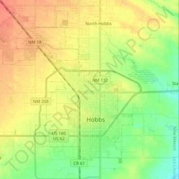
Name: Hobbs topographic map, elevation, terrain.

Location: Hobbs, Lea County, New Mexico, United States (32.66756 -103.23092 32.78735 -103.09479)

Average elevation: 3,635 ft

Minimum elevation: 3,563 ft

Maximum elevation: 3,701 ft

Lea County trails, hiking, mountain biking, running and outdoor activities

Other topographic maps

Click on a map to view its topography, its elevation and its terrain.

Arkansas Junction

United States > New Mexico > Lea County

Average elevation: 3,799 ft

Monument

United States > New Mexico > Lea County

Average elevation: 3,599 ft

Nadine

United States > New Mexico > Lea County

Average elevation: 3,589 ft

Gear up for your next adventure:

🔭Compact Binoculars - HD vision for scouting terrain and identifying distant landmarks
🪶Camp Gear Gift Set - Perfect gift bundle for outdoor fans
🛏️Cold Weather Sleeping Bag - Warm sleeping bag for cold conditions
🔥Camping Stove - Portable stove for camping and backcountry cooking
Solar GPS Watches - Advanced multisport watches with built-in topographic maps

As an Amazon Associate, this site earns from qualifying purchases at no extra cost to you.