Geolocate

Houston topographic map

Click on the map to display elevation.

About this map

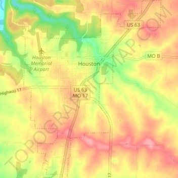
Name: Houston topographic map, elevation, terrain.

Location: Houston, Texas County, Missouri, 65483, United States (37.29451 -91.97944 37.34376 -91.93094)

Average elevation: 1,184 ft

Minimum elevation: 988 ft

Maximum elevation: 1,319 ft

Other topographic maps

Click on a map to view its topography, its elevation and its terrain.

Hartshorn

United States > Missouri > Texas County

Average elevation: 1,260 ft

Mineral Springs City

United States > Missouri > Texas County > Houston

Average elevation: 1,188 ft

Gear up for your next adventure:

🧦Merino Wool Socks - Moisture-wicking, blister-preventing socks for long treks
📚USA Hiking Guide Books - Top trail guides and map books
🚪Portable Camp Chair - Foldable chair for comfort at camp
🛡️Bear Spray Outdoor - Protection in bear country hikes
🥾Women's Hiking Boots - Top-rated trail boots with ankle support and superior grip

As an Amazon Associate, this site earns from qualifying purchases at no extra cost to you.