Geolocate

Hartshorn topographic map

Click on the map to display elevation.

About this map

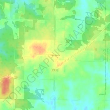
Name: Hartshorn topographic map, elevation, terrain.

Location: Hartshorn, Texas County, Missouri, 65479, United States (37.24477 -91.69042 37.28477 -91.65042)

Average elevation: 1,260 ft

Minimum elevation: 1,191 ft

Maximum elevation: 1,352 ft

Texas County trails, hiking, mountain biking, running and outdoor activities

Other topographic maps

Click on a map to view its topography, its elevation and its terrain.

Raymondville

United States > Missouri > Texas County

Average elevation: 1,329 ft

Houston

United States > Missouri > Texas County

Average elevation: 1,184 ft

Summersville

United States > Missouri > Texas County

Average elevation: 1,204 ft

Gear up for your next adventure:

🧦Hiking Socks - Comfortable socks to prevent blisters on long hikes
🔌Solar Panel Charger - Charge gear sustainably outdoors
📶Vehicle Signal Boosters - Improve reception in rural areas while driving to trailheads
Backpacking Tent - Lightweight and durable tent for multi‑day hikes
🏥Hiking First Aid Kits - Comprehensive medical kits for remote trail injuries

As an Amazon Associate, this site earns from qualifying purchases at no extra cost to you.